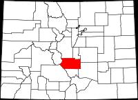
Fremont County, Colorado
County Seat and Largest City: Cañon City
Total Land: 1,533.95 sq. mi (3,973 km²,)
Population: (2010) 46,824, 13th most populous Colorado county
Density: 30.5/sq. mi (11.8/km²)
Visit the Fremont County website.
Visit the Wikipedia page for Fremont County, Colorado.
Fremont County is located in south-central Colorado, bordered by the Sangre de Cristo Mountains on the west and stretching to the semi-arid high plains on the east, with an elevation range of 5,000 to over 12,000 feet. The Arkansas River, the largest river on Colorado’s eastern slope, bisects from west to east the County’s approximately 1,500 square miles.
Active land uses within the County include mining and mineral processing, commercial trade, agriculture and cattle ranching, manufacturing, and recreation/tourism. Nearly half of the County is federal or state public land, managed by the U.S. Forest Service, the Bureau of Land Management, or the Colorado Division of Parks and Outdoor Recreation or the Division of Wildlife. There are also numerous State Land Board tracts. These large areas of open land are the essential features of the recreational opportunities and scenic qualities that attract visitors to Fremont County; however, these large tracts of government owned properties also decrease the property tax revenues the County receives.
Fremont County lies along the edge of the Front Range, within 50 miles of two Front Range cities--Denver and Colorado Springs--and at the gateway to the Royal Gorge and mountain region of the U.S. Highway 50 corridor. This unique and strategic location provides the County with a diversity of opportunities and people.
Over 90% of the County’s 46,145 people reside in the three eastern communities and Brookside is strategically located between Florence, Coal Creek, Rockvale, Williamsburg and Canon City. (Description taken from the Fremont County Master Plan)